
Shuttle transport for hikers, trekkers and trampers in Nelson Lakes National Park and the Top of the South, New Zealand

Nelson Lakes Shuttles
Ph: +64 (3) 540 2042
Mobile 027 222 1872


Trip Reports : Rainbow Pass - Travers Saddle
Updated 1st Febraury 2011
By Richard Bulmer
JANUARY 2006
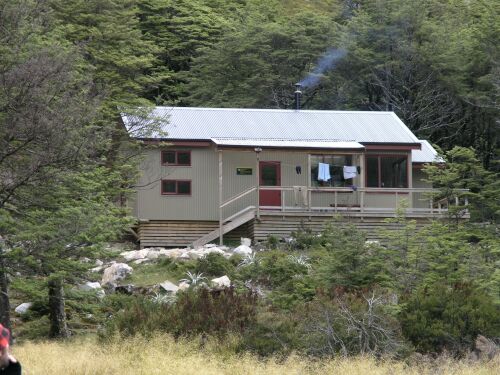
Picture (1) Location: below Travers Hut. The Upper Travers Hut
These pictures were taken after two consecutive days of a summer snow storm down to 1200 meters. Three days later, when taken, both passes were free of snow, showing that it did not remain more than a day or two at this time of year.
The “location” refers to the camera.
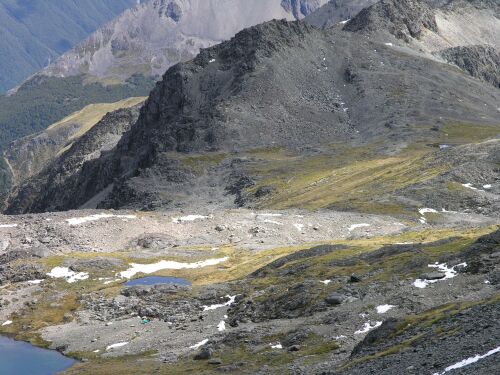
Picture (2) Location 882082. Zoom shot. Travers Saddle on the Sabine side of the pass. The track (obscure) rises to the saddle (near to the small tarn centre right) and follows the green area before descending steeply to the south, (centre left of the frame).
Picture (3) Location: 878089 (Travers Saddle). Looking southeast to Rainbow pass on the skyline. The tarn (obscured) lies in the centre of the frame behind the rounded moraine debris.
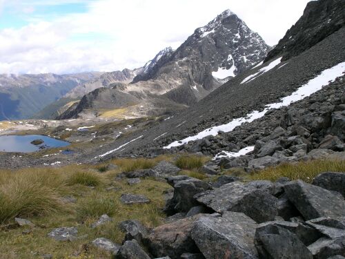
Picture (4) Location 882082. 100 meters below Rainbow Pass. Looking northwest and down on Travers Saddle. Mt. Travers is in the background. The tarn is unnamed.
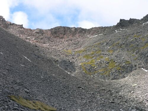
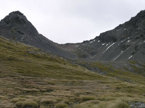
Picture (5) Location 882082. 100 meters below Rainbow Pass on the northwest side. Looking southeast and up to Rainbow Pass. The pass is below the hook of rock on the skyline (top left of frame).
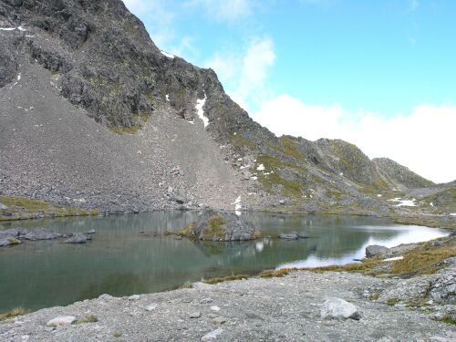
Picture (6) Location 880084. The un-named tarn on the northwest side and 200meters below Rainbow Pass.
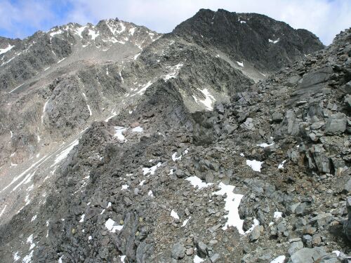
Picture (7) Location 884081. Rainbow Pass taken from the rocks above and to the northeast side of it.
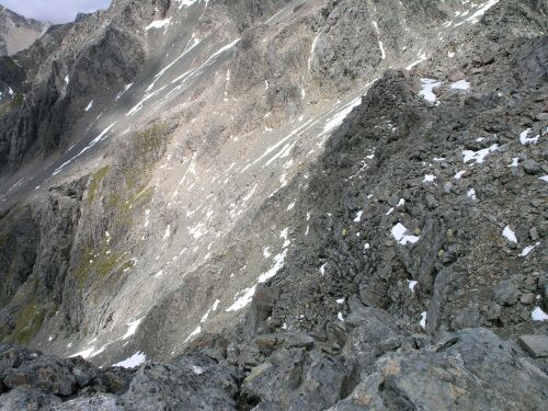
Picture (8) Location 884081. Rainbow Pass taken from the rocks above and to the northeast side of it. The pass is adjacent the small patch of flat snow to the top centre & extreme right of the picture. The frame shows the steep bluffs on the southeast side of the pass which should be avoided. The preferred route when travelling from the west side comes up to the camera position and then descends down a rock spur 50 meters below the camera to an unstable scree slope. This scree (out of frame) is a rock fall area from the unstable cliffs above and should be traversed with caution.
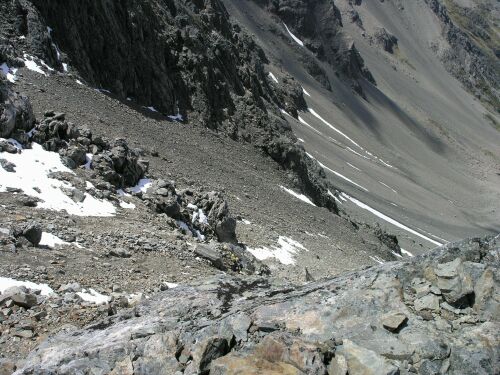
Picture (9) Location 884081. Rainbow Pass descent over rocky spur to scree slopes below. Scree in centre is directly below an unstable rocky bluff and should be negotiated with caution.
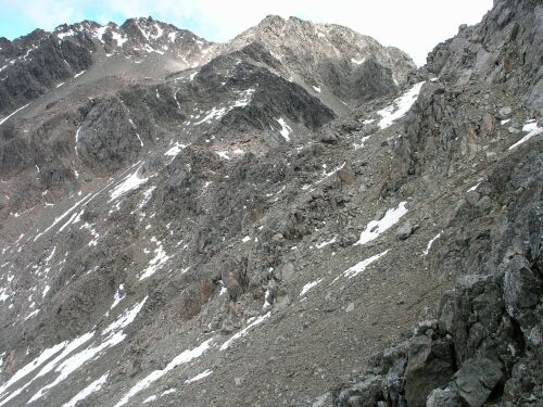
Picture (10) Location 886081. The southeast side of Rainbow pass looking southwest. The route from the southwest traverses to the rocky spur (centre right of picture) and descends to the scree slope in the lower centre of the frame. This scree is a rock fall area from the unstable cliffs above and should be traversed with caution.
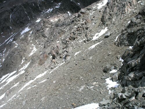
Picture (11) Location 886081. Looking down on the southeast side of Rainbow Pass. The route from the northwest climbs the rock ridge to the northeast of the pass and then down the rocky spur centre right of picture and descends to the scree slope in the lower centre of the frame. This scree is a rock fall area from the unstable cliffs above and should be traversed with caution.
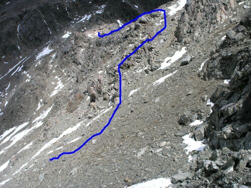
Picture (11pen) Location 886081 Shows the pencilled route on picture 11.
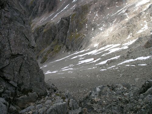
Picture (12) Location 886081. Scree slope below Rainbow Pass. Taken from rocks above. The scree slope gives access to the valley on the south east side.
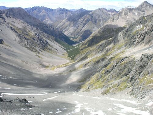
Picture(13) Location 882081. Rainbow valley looking southeast. The junction with the Paske creek lies beyond. The route down the scree is to the lower left passing near the rocky outcrop.
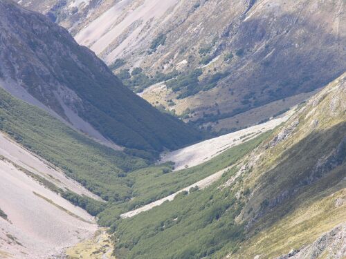
Picture (14) Location 882081. Rainbow valley zoom shot looking southeast, showing the vegetated part of the valley and beyond towards the Paske creek junction.
INFORMATION NOT FOR PUBLICATION
4-53 Kotare Street, Waikanae 6010, Kapiti Coast
email: bruce.b@clear.net.nz
(021) 23-69-394
